Best Things to Do in San Francisco for 2026
A working list of the city's real attractions, organized the way San Francisco actually sits on the map, from the waterfront to the ocean.
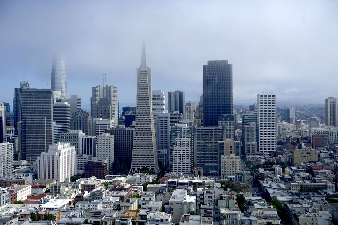
The fog comes over Twin Peaks first, usually, spilling down toward the Castro and the Mission like something poured rather than blown, and by the time it reaches downtown the tourists in shorts are hugging themselves outside the Ferry Building wondering what happened to July. Locals know this is just Tuesday. Any honest guide to the best things to do in San Francisco has to admit up front that the weather here does not care about your itinerary, and neither does the topography. Dozens of hills are stacked into these seven miles by seven miles, so the view changes every few blocks and each neighborhood's personality shifts along with it. What follows is not a highlight reel borrowed from someone else's weekend. It is a working list, organized the way the city actually sits on the map, working from the waterfront out to the ocean across the hills in between, with honest notes on what earns your time and what to skip if the fog rolls in.
The best things to do in San Francisco start on the water
Start at the Embarcadero, the wide curving street that traces the eastern edge of the peninsula from the ballpark up past the piers to Fisherman's Wharf. Here the city faces the bay instead of the ocean, and on a clear afternoon you can watch container ships slide under the Bay Bridge while a ferry loads commuters headed to Sausalito or Oakland. The palm trees along here look imported because they are, planted for the 1915 Panama-Pacific Exposition, but the working waterfront underneath them is real. Runners and cyclists claim the wide promenade early, before the ferry commuters and the tour groups fill it in. Crab boats still dock near Pier 45, and the sea lions that colonized Pier 39 in the early 1990s never got the memo that they were supposed to move on eventually.
The Ferry Building and the farmers market
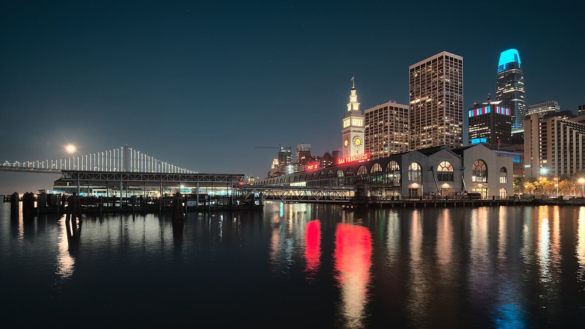
The Ferry Building has anchored this stretch of waterfront since the late 1800s, surviving the 1906 earthquake when most of downtown did not, and every local already has an opinion about which stall inside makes the better sandwich. The building itself rewards a slow walk through, a marketplace of small food producers under a restored nave, with a farmers market that spills into the plaza outside a few days a week, thick with stone fruit in summer and Dungeness crab once the season opens. Skip the instinct to just photograph the clock tower from across the street. Go inside. Arrive on a weekday morning before the cruise crowds show up and you can actually get a seat by the water.

Alcatraz
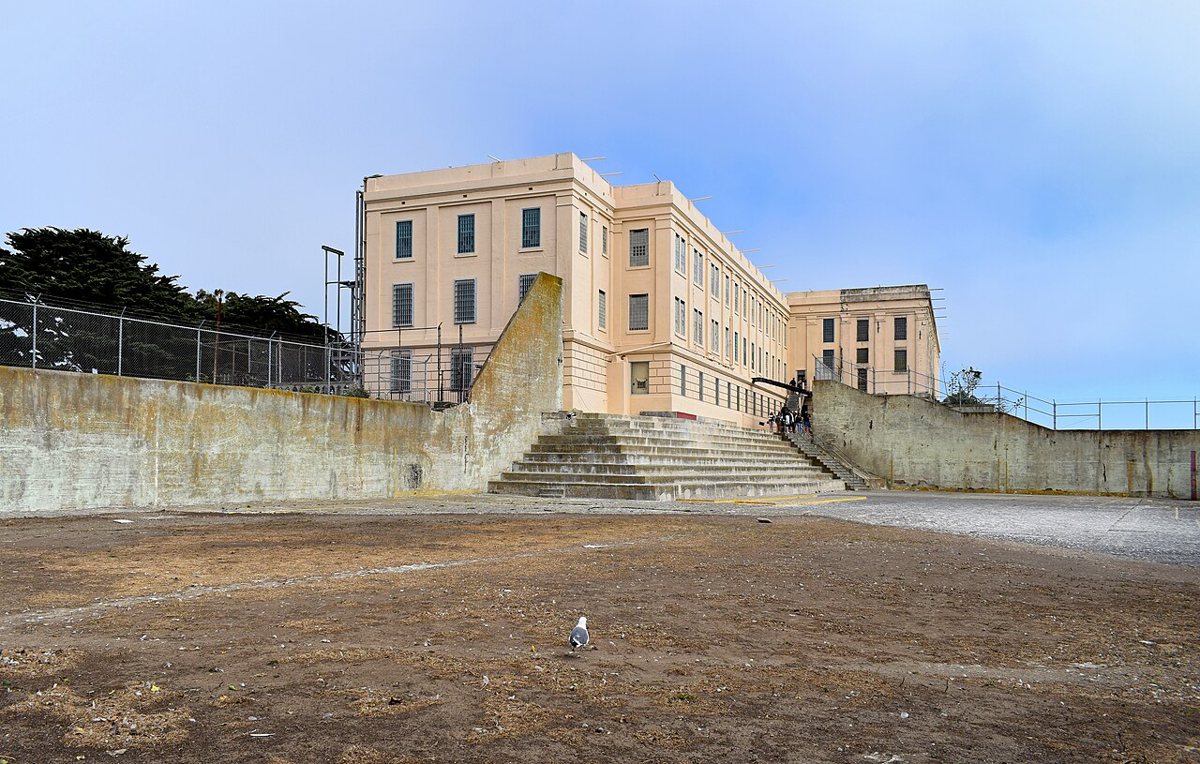
Alcatraz sits about a mile and a half offshore, close enough that foghorns from the island used to carry across the water to Fisherman's Wharf, far enough that the currents made escape close to impossible for the men held there. The boat ride alone earns the trip, since it gives you a skyline view most visitors never bother to seek out, and the cellhouse audio tour, narrated partly by former inmates and guards, does more work than any placard could. Bring a jacket regardless of what downtown feels like when you leave. Reserve your ferry slot before you land in the city rather than hoping to walk up, since sailings do sell out days in advance, especially in the warmer months.

Chinatown, North Beach, and the hills between them
Climb west from the Embarcadero and the city stacks up fast: Chinatown gives way to North Beach, North Beach climbs into Telegraph Hill and then Russian Hill, and somewhere in the middle you are catching your breath on a corner with a view that would cost a fortune anywhere else. Fisherman's Wharf sits at the northern edge of this stretch, and it earns a more skeptical look than most guides give it. The sourdough bowls and saltwater taffy shops are aimed squarely at tourists. Pier 39's sea lions are genuinely wild animals doing what they want on public docks, and the walk along Jefferson Street toward Ghirardelli Square still passes real fishing boats unloading real catch some mornings. Wear real walking shoes for this stretch, worth every calf muscle it demands.
Chinatown
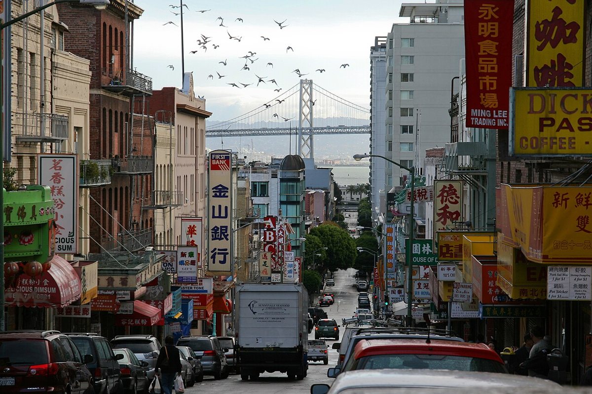
San Francisco's Chinatown is the oldest in North America and one of the densest neighborhoods in the city, and it operates on two levels at once. Grant Avenue is the postcard version, pagoda roofs and souvenir shops. A block over, Stockton Street is where the neighborhood actually shops, produce stacked on the sidewalk and fish markets doing real business before most tourists are awake. Duck down Ross Alley if you want to watch fortune cookies get folded by hand. Herb shops with drawers of dried roots line the side streets, and the bakeries selling egg tarts and barbecue pork buns do a steady trade all morning. Walk Stockton first, then cut over to Grant, so the tourist strip reads as a postscript rather than the whole story.

Coit Tower and Telegraph Hill
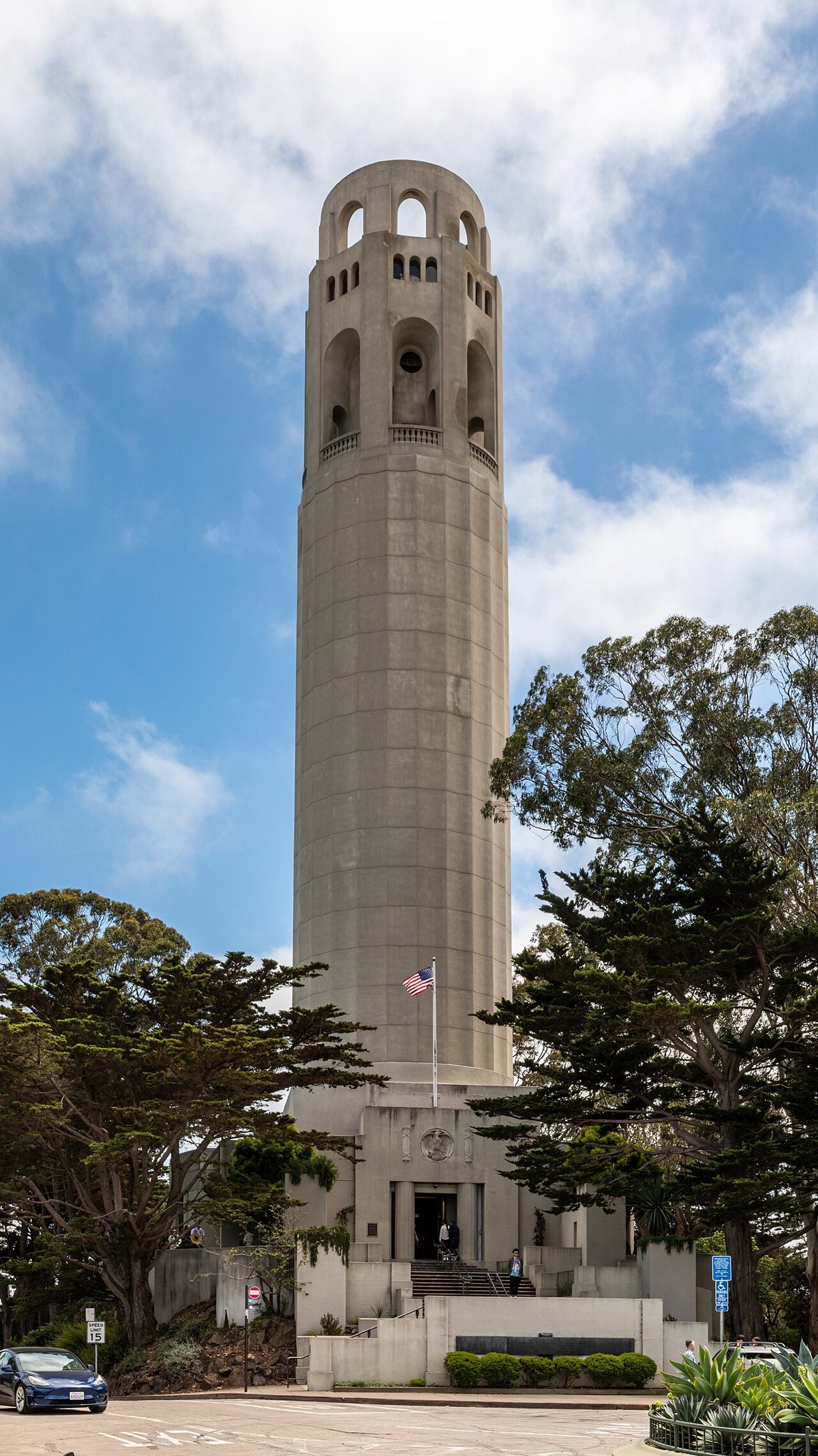
Coit Tower was funded by Lillie Hitchcock Coit, a North Beach eccentric who loved firehouses more than most people love their own families, and the fluted concrete column has topped Telegraph Hill since 1933. Inside, the lobby murals painted by local artists during the Depression are worth the wait for the elevator on their own. Outside, the wild parrots of Telegraph Hill, an actual flock of feral conures descended from escaped pets, still shriek through the cypress trees. Head down the Filbert Steps on the east side afterward, past cottage gardens and hummingbirds, instead of retracing your route by car.

Lombard Street
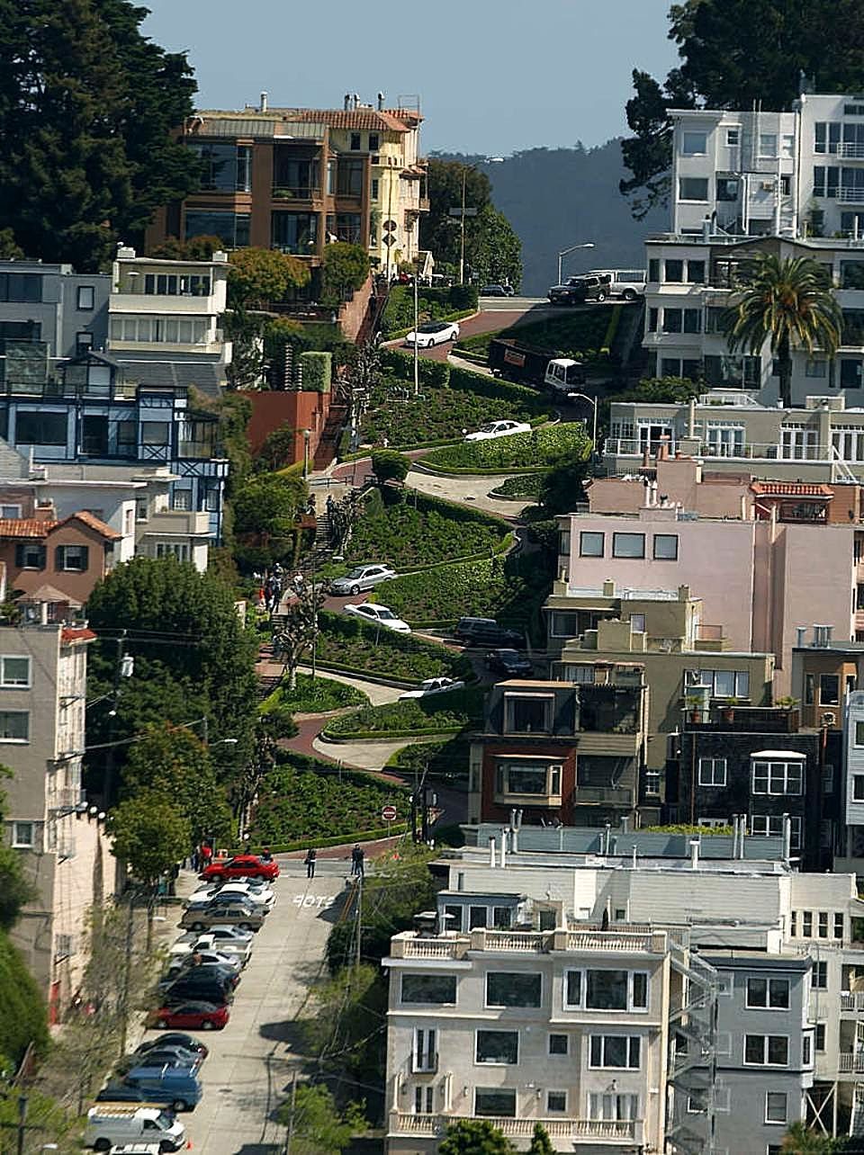
The famously crooked block of Lombard Street between Hyde and Leavenworth was engineered as a series of switchbacks in the 1920s because the natural grade was too steep for cars, not for the postcard. Driving it is a slow crawl behind other tourists doing the same thing. Walking it, from the top down, is faster and lets you actually look at the hydrangeas instead of the bumper ahead of you. Once you're at the bottom, walk over to the Hyde Street cable car turnaround and treat yourself to an Irish coffee at the Buena Vista, a neighborhood ritual since well before anyone was posting about it.

The Presidio, the bridge, and the Marina
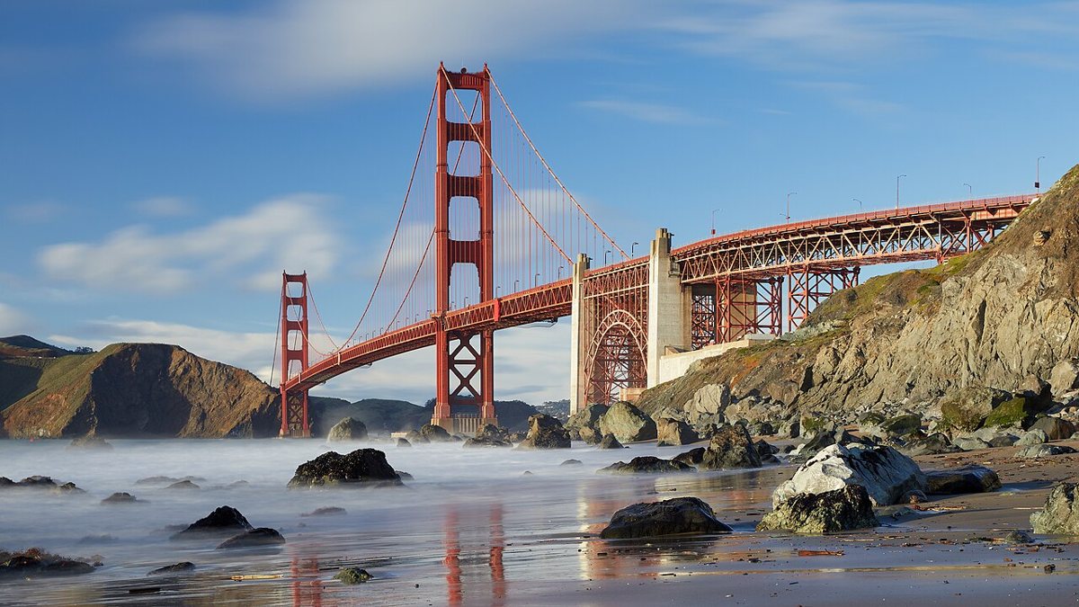
The Presidio spent more than two centuries as a military post. It started as a Spanish outpost, later Mexican, before the United States Army took it over, and it became a national park in the 1990s. The result is unlike anywhere else in the city: forested trails and old officers' quarters instead of triple-decker Victorians, with the bridge itself as the anchor at the northern edge. Baker Beach sits below the eucalyptus groves on the Presidio's western flank, cold water and strong currents that make it a place for walking rather than swimming, with a straight-on view of the bridge that surprises people who assumed you had to be standing on it to appreciate the scale. Crissy Field's restored marsh and beach trace the northern edge of the Presidio, drawing kite flyers and dog walkers who never bother looking up at the bridge towering above them.
Golden Gate Bridge
The bridge is painted international orange specifically because the color holds up against the fog, and on the days when that fog is pouring through the towers like smoke, the whole structure looks half-imagined. Walk or bike across the pedestrian path if your legs and schedule allow it, since the view back at the city, framed by cable and fog, is worth more than any lookout point photo. Start from the San Francisco side in the morning, before the wind picks up, and consider biking down to Sausalito and taking the ferry back rather than doubling the walk.

The Palace of Fine Arts
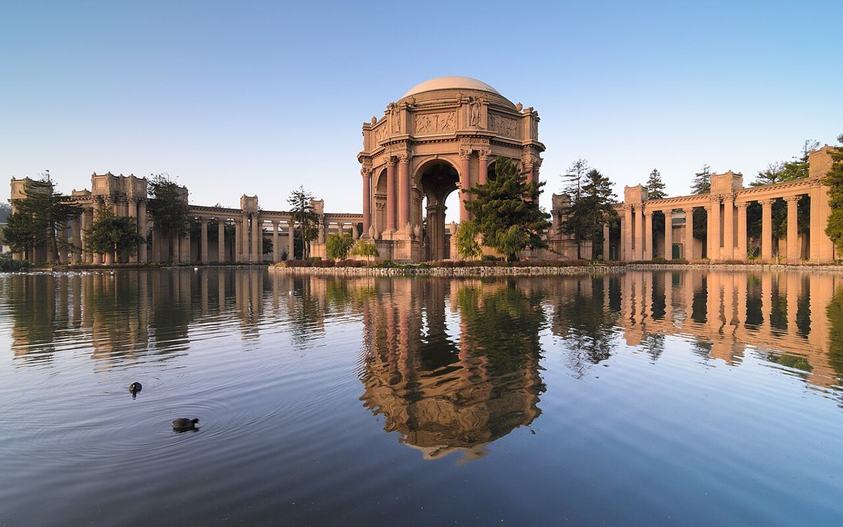
Built for the 1915 Panama-Pacific International Exposition, the Palace of Fine Arts is the only structure from that fair still standing, a domed rotunda and curved colonnade set beside a small lagoon patrolled by swans and the occasional heron. Nearly everything around it in 1915 was temporary plaster, meant to be torn down after the fair closed, so its survival owes as much to neighborhood affection as to engineering. It costs nothing to wander the grounds. Visit in the late afternoon, when the light softens the columns and the tour buses have mostly cleared out.

Golden Gate Park and the fog belt
Golden Gate Park runs three miles from the edge of the Haight straight out to the ocean, wider than it is long, and it borders the Richmond District to the north, where the fog tends to sit thickest and the dim sum houses along Clement Street stay full on weekends regardless of weather. If you want a proper Richmond dim sum crawl before or after a day in the park, this is the neighborhood for it. Stow Lake, near the park's center, circles a small wooded island where paddleboats drift past turtles sunning themselves on half-submerged logs.
Golden Gate Park
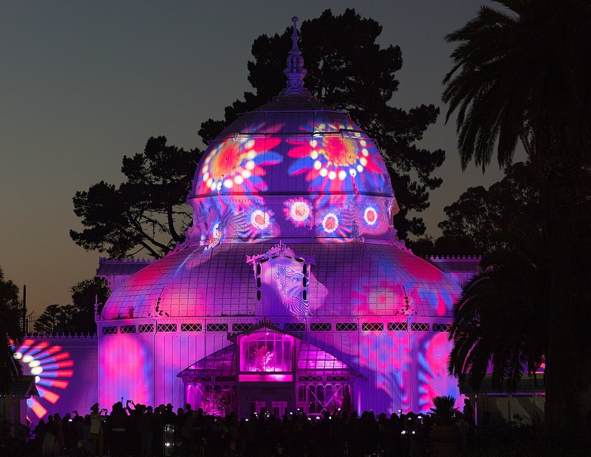
The park holds a bison paddock that predates most people's assumptions about what belongs in a city park. It also holds the Japanese Tea Garden and the Conservatory of Flowers. Its meadows and groves alone could fill a week without repeating a path. On Sundays, long stretches of the park's main road close to cars, which turns the whole place over to cyclists, skaters, joggers, and stroller traffic. Rent a bike near the panhandle end and ride the car-free road straight out to the ocean, since it beats driving in every way that matters.

The de Young Museum
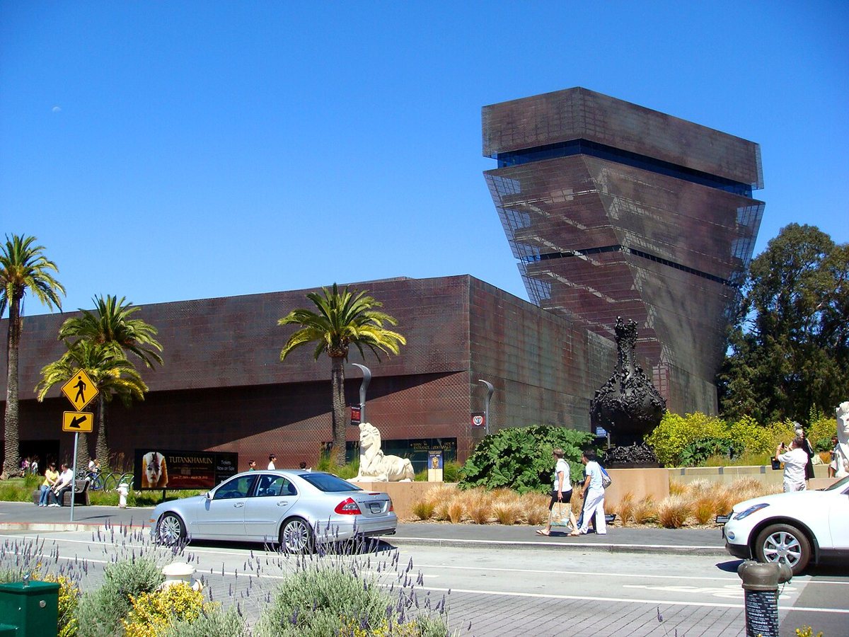
The de Young's copper facade was installed shiny and has been slowly weathering toward green ever since, which is either a metaphor for the city or just what copper does outdoors. The permanent collection covers American art and textiles, and reaches into art from Africa and Oceania, with rotating shows usually worth checking before you go. The real secret is the observation tower, which is free to ride up even if you skip the galleries. Take the elevator up first, before your legs are tired, for a 360-degree view of the park and the fog line beyond it.

Lands End
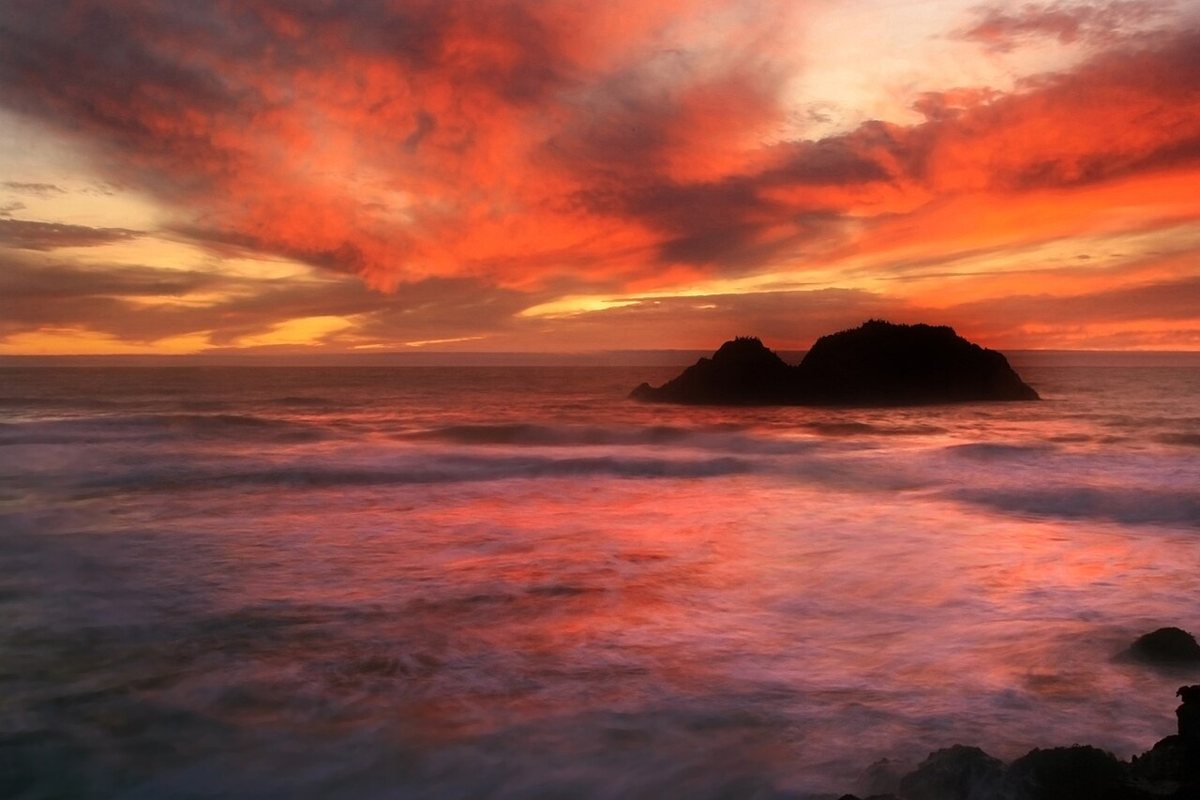
Lands End is the part of the city that looks the least like the postcards, a rugged coastal trail along cypress and eucalyptus with the ruins of the old Sutro Baths crumbling into the surf below. From certain overlooks you can see the Golden Gate Bridge from the west, a different angle than almost anyone photographs, with the open Pacific behind it instead of the bay. The trail is uneven in places and the wind off the water is real, so dress like it. Time it for sunset on a clear evening, which happens more often out here than the fog's reputation suggests.

The Mission, the Castro, and the neighborhoods that hold the city together
Move east and south from the park and the fog thins out fast. The Mission has been the center of Latino San Francisco for generations, its murals and taquerias doing more to define the city than any postcard skyline, and the Castro next door carries its own weight as the center of LGBTQ history and nightlife on the West Coast. Neither neighborhood exists to be photographed. Both reward slowing down.
Dolores Park
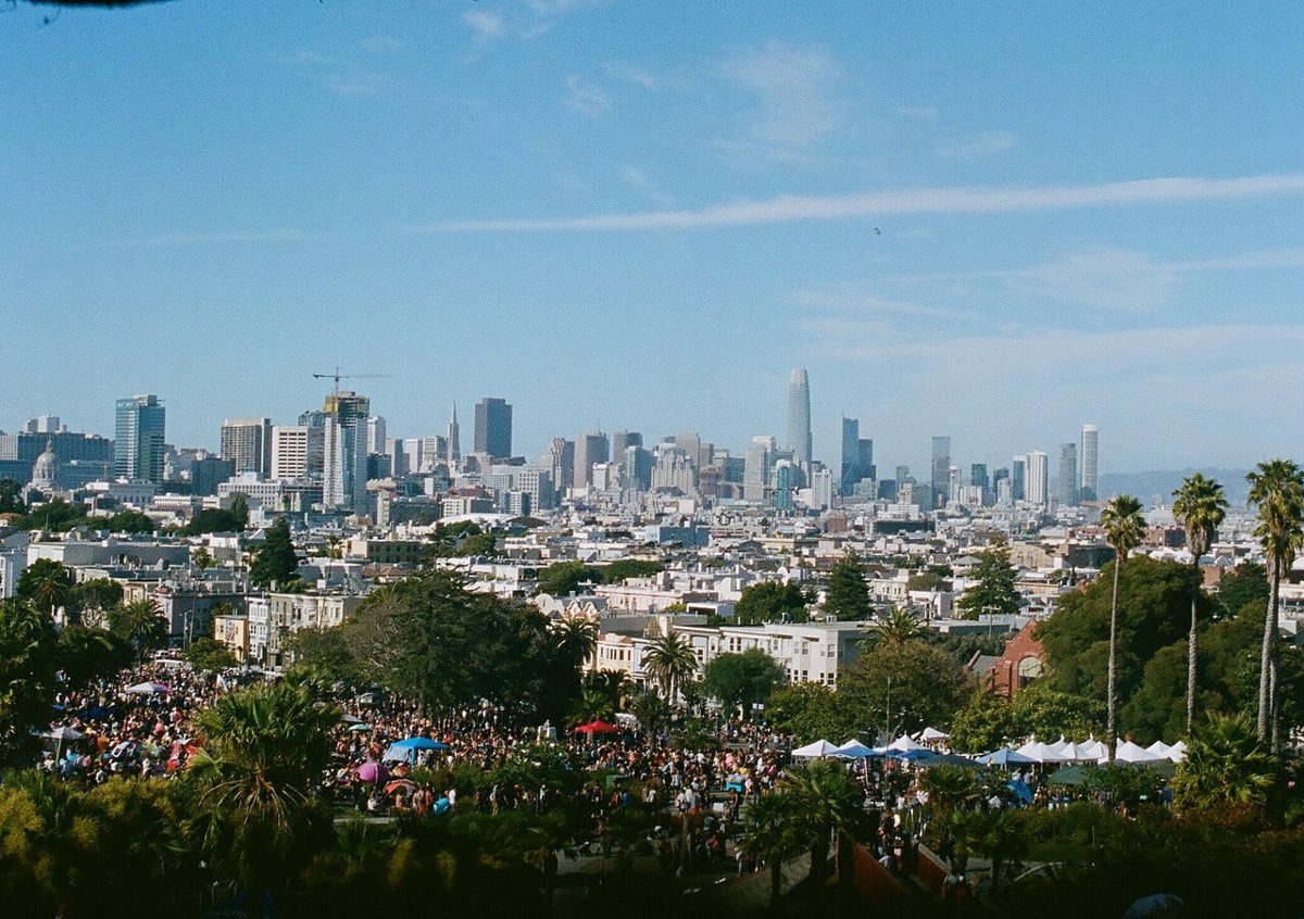
Dolores Park sits on a hillside in the Mission, and the slope does the work of an amphitheater, so every patch of grass has a sightline toward the downtown skyline and the twin spires of Mission Dolores below. On a sunny weekend it fills with picnic blankets and taco carts, with enough dogs on leashes to stock a shelter, and the crowd is as much the show as the view. West-facing grass gets more afternoon sun, but the east side has the better skyline angle, so pick your priority before you stake out a spot.

The murals of the Mission
Balmy Alley and Clarion Alley have been canvases for political and community muralism since the 1970s and 1980s, layered and repainted over decades, covering everything from Central American solidarity movements to tributes to neighborhood elders. Walking either alley slowly, rather than snapping a quick photo and moving on, is the only way to actually see what's there. Afterward, get a proper foil-wrapped burrito at one of the neighborhood's taquerias, rice and all, the way it's supposed to be built. Go on foot and go slow, since these alleys were not made for a drive-by.
The Castro
The Castro Theatre's marquee has anchored this stretch of Castro Street for a century, and the neighborhood around it holds the memory of Harvey Milk's camera shop and the early gay rights movement. Decades of nightlife here shaped how the rest of the country came to understand queer culture in America. The rainbow crosswalks at Castro and 18th are not just decoration. Stop at the GLBT Historical Society Museum if you want the history with real depth instead of the highlight version. Come back after dark, since the neighborhood's real character shows up once the bars and cafes fill in.
Alamo Square and the Painted Ladies
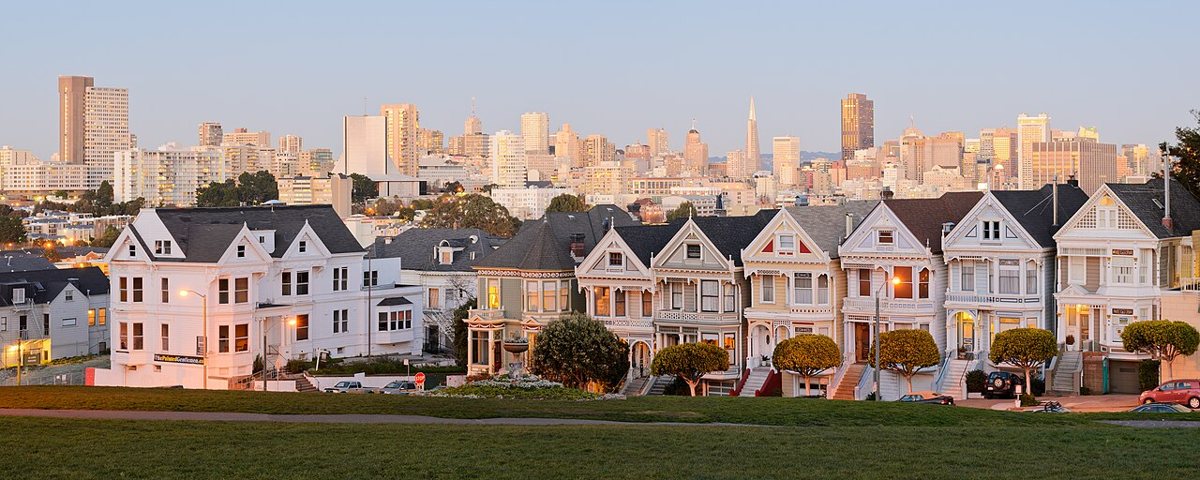
The row of Victorian houses on the east side of Alamo Square, painted in contrasting pastel colors and lined up against the downtown skyline, draws a steady line of photographers most days, largely because a long-running sitcom used that exact view in its opening credits. The houses are private homes, so the view is the whole point, not an invitation to wander the porches. Early morning brings softer light and thinner crowds, before the sidewalk in front fills with tour groups by midday.

Getting around, timing it right, and what actually costs nothing
Muni, BART, and your own two feet
BART connects downtown to the East Bay and the airport, but it only clips through a handful of San Francisco neighborhoods, so Muni's buses and light rail, plus the historic streetcars on Market Street, do most of the real work inside the city. The cable cars are a genuine mode of transit as well as an attraction, though the lines to board can run long at the turnarounds, and hopping on partway up a hill away from the main turnaround usually beats waiting in line. Driving here means hunting for parking on hills steep enough to require a real understanding of your emergency brake, so most residents treat a car as a last resort rather than a default. Walking is often faster than it looks on a map, since the grid is compact even when the hills make it feel otherwise, and a rideshare across a dense neighborhood at rush hour can take longer than just walking it. Bike lanes have expanded across the flatter neighborhoods in recent years, and an e-bike flattens out the hills that would otherwise turn a casual ride into a workout.
The fog is not a flaw in the plan
San Francisco runs several microclimates at once, so it is entirely possible for the Sunset to sit under a gray lid while the Mission bakes in sun a couple of miles away. Summer tends to bring the thickest fog to the west side and the coast, while early fall usually delivers the clearest, warmest stretch of the year citywide. Pack layers no matter when you come, and treat the fog as part of the scenery rather than a delay to your plans. Some of the best views of the bridge happen exactly when the fog is doing something dramatic to it.
What's free
- Walking or biking across the Golden Gate Bridge on the pedestrian path
- The trails, meadows, gardens, and groves of Golden Gate Park outside its ticketed attractions
- Lands End's coastal trail and the Sutro Baths ruins
- The murals of Balmy Alley and Clarion Alley in the Mission
- Dolores Park and Alamo Square
- Watching the sea lions haul out at Pier 39
- The Presidio's trails and overlooks, including Baker Beach
What the postcard leaves out
None of this holds still. The Mission's rents have pushed out families who built the neighborhood's culture in the first place, even as its murals and taquerias get marketed as the city's soul. SoMa's office towers house companies that reshaped this city's economy and its skyline in a generation, and treating that transformation as pure progress ignores what it displaced and who it left behind. The encampments you'll pass near the Tenderloin or under a few freeway overpasses are not scenery to route around, and no list of attractions should pretend otherwise. They're the visible edge of a housing and mental health crisis the city has failed to solve for decades, list or no list.
What keeps San Francisco worth defending, fog and all, is that none of its neighborhoods asked permission to be interesting. The Mission didn't become the Mission because a tourism board decided it should. The Castro didn't become a center of queer history because it was convenient. San Francisco built its character through people staying put, decade after decade, in neighborhoods that outsiders kept trying to rename or reduce to a single view. That loyalty is stubborn rather than sentimental. Ask anyone who has lived here through a boom and a bust, sometimes twice, and they will tell you the skyline changed faster than the corner store did, and that the corner store is the part worth protecting. The fog will still roll over Twin Peaks long after this list is out of date, and the neighborhoods underneath it will keep changing on their own schedule, not the tourism calendar's. Come for the bridge, the park, the murals, and the neighborhoods that hold it all together. Leave having learned the difference between the city and the postcard of it.